Månadsarkiv: maj 2016

Dag 57 – Inget möte i Södertälje

Morgonen började med ett strålande väder och jag begav mig mot Södertälje. Min plan till genväg gick i stöpet då det jag från satellitfoto trodde var en okarterad stig visade sig vara ett dike. Men väl inne i Södertälje vände lyckan. Actic inte bara lånade ut en dusch, utan när jag frågade om de visste var man kunde tvätta erbjöd de mig att köra en maskin där. Tack! Medan den körde tog jag en fika i cafét bredvid biblioteket och jobbade lite.

Jag fick tyvärr inte ens en fika med kommunen, trots stort folkligt stöd.

Sen eftermiddag begav jag mig mot Botkyrka i ett riktigt soligt väder. Det blev en fin promenad på cykelstigar och genom naturreservat.

[mapsmarker layer=”58″]

Statistik

För alla dagar, se statistiksidan.

Sträcka

[table]
Sträcka (km),Total sträcka (km),Snitt/dag
23.03,997.35,17.50
[/table]

Google Fit

[table]
Sträcka (km),Tid (tt:mm),Steg (st)
11.63,04:40,22553
[/table]

Ekonomi

[table]
Matkostnader (kr),Mat totalt (kr),Mat/dag,Projektkostnader (kr)
232,6036,106,
[/table]

Day 56 – last day as @sweden

The night had a lot of rain, and probably a visit by wold boars close outside my hammock. But it was warm and I slept well.

I started walking, and it was quite nice weather. When I came to a place with a little less traffic, I tried a 360 live stream video.

Then I kept on walking, looking for a good place to stop. I finally found it, and it was actually the stop I had my routing for. So this was a nice week, being @sweden, now everything is going to seem so calm.

[mapsmarker layer=”57″]

Statistics

For all days, see the statistics page.

Stretch

[table]
Stretch (km),Total stretch (km),Average/day
17.83,974.32,17.40
[/table]

Google Fit

[table]
Stretch (km),Time (hh:mm),Steps (#)
11.04,03:34,20624
[/table]

Finances

[table]
Food costs (SEK),Food total (SEK),Food/day,Project costs (SEK)
0,5804,104,
[/table]

Day 55 – into Stockholm county

The morning started with a change. The forecast that had said it should stop raining at 10.00 now said it would start rain at 11.00. So instead of a sleep-in I hurried up and started walking. It was a beautiful start through the Tullgarn nature care area.

Then I came to a more trafficked road, which had a bike lane. The rest of the walk was done in a hurry. I managed to setup my hammock before the rain.


[mapsmarker layer=”56″]

Statistics

For all days, see the statistics page.

Stretch

[table]
Stretch (km),Total stretch (km),Average/day
8.49,956.49,17.39
[/table]

Google Fit

[table]
Stretch (km),Time (hh:mm),Steps (#)
6.58,01:26,11292
[/table]

Finances

[table]
Food costs (SEK),Food total (SEK),Food/day,Project costs (SEK)
0,5804,106,
[/table]

Day 54 – meeting with Trosa municipality

The morning started with nice weather after rain during the night. A short walk took me into Trosa and in the guest harbour I found both a shower and some coffee. Great start of the day.

It started raining, so instead of relaxing in the harbour I headed for the library and got some work done. A few municipality pages got updated and some images uploaded to Mapillary. Then I headed to the meeting with the municipality. It was a warm welcome and the 5 civil servants that attended seemed very interested and curious. They also had a few ideas they would start with which always is nice.

On the way out of Trosa I bought some food. It was rainy, but the walk was quite nice anyway. Due to all the things I stopped and took pictures of, I arrived quite late to my goal for the day.

[mapsmarker layer=”55″]

Statistics

For all days, see the statistics page.

Stretch

[table]
Stretch (km),Total stretch (km),Average/day
15.75,948,17.56
[/table]

Google Fit

[table]
Stretch (km),Time (hh:mm),Steps (#)
13.9,03:08,22069
[/table]

Finances

[table]
Food costs (SEK),Food total (SEK),Food/day,Project costs (SEK)
370,5804,107,25
[/table]

Day 53 – early morning

I got up really early to be able to finish walking for the day before the rain and was met by a beautiful morning.

I packed my things and left.

After a few hours of uneventful walking I got to my goal for the day.

I took a short nap before getting some work done.

[mapsmarker layer=”54″]

Statistics

For all days, see the statistics page.

Stretch

[table]
Stretch (km),Total stretch (km),Average/day
18.97,932.25,17.59
[/table]

Google Fit

[table]
Stretch (km),Time (hh:mm),Steps (#)
13.4,02:44,19437
[/table]

Finances

[table]
Food costs (SEK),Food total (SEK),Food/day,Project costs (SEK)
0,5434,103,
[/table]

Day 52 – Colder walking

It was a quiet and warm night, but as the morning came the temperature failed to rise.

The increasing wind added to the chill factor. The road did not have so much traffic so the walking was ok, but it didn’t have so many great views either. I marched on, knowing that the rain would come later.

I made it with a small margin, but any margin is enough.

[mapsmarker layer=”53″]

Statistics

For all days, see the statistics page.

Stretch

[table]
Stretch (km),Total stretch (km),Average/day
21.5,913.28,17.56
[/table]

Google Fit

[table]
Stretch (km),Time (hh:mm),Steps (#)
18.1,04:00,28015
[/table]

Finances

[table]
Food costs (SEK),Food total (SEK),Food/day,Project costs (SEK)
0,5434,105,
[/table]

Day 51 – one meeting in Nyköping but not the municipality

Yet another warm night in a beautiful spot.


My impulse buy yesterday of radishes made for some great variation to the breakfast. It was a bit longer than expected to Nyköping, but a nice walk in the beautiful weather. I managed to leave some clothes to a cleaner and he promised to have them done during the day. Next stop the library where I managed to catch up all the way with Mapillary uploads and also get some videos uploaded to Wikimedia Commons (I especially like this one of a bug that landed on my hat the other day). I was so caught up in it so I forgot to eat lunch, but as I went to the Wikipedia meetup, I made up for that.

It was a nice meetup with Albin Larsson and we talked about different tools to help wikipedians. After that I got my clothes from the cleaner and shopped some food before I started my walk towards Trosa. Beautiful weather made it a nice evening walk.

Screenshot 2016-05-24 at 21.29.35

[mapsmarker layer=”52″]

Statistics

For all days, see the statistics page.

Stretch

[table]
Stretch (km),Total stretch (km),Average/day
15.61,891.78,17.49
[/table]

Google Fit

[table]
Stretch (km),Time (hh:mm),Steps (#)
11.65,02:51,19631
[/table]

Finances

[table]
Food costs (SEK),Food total (SEK),Food/day,Project costs (SEK)
252,5434,107,300
[/table]

Day 50 – Oxelösund and being @sweden

Swedish version below / Svensk version nedan

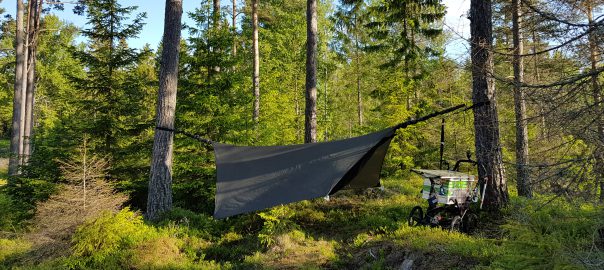
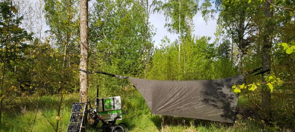
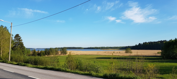
It was a the warmest night so far, easily above 10 degrees Celsius. I got up and had breakfast as usual in this nice forest before I started my walk into Oxelsöund.

Halfway there, I got the call from Visit Sweden with the credentials to access the @sweden account. I started off to introduce myself with a couple of tweets and contunued walking. I just happened to saw a gym and a manager that was opening the door so I asked if I could use the shower, which I could. Afterwards I was even treated to a cup of coffee!

I headed to the library to get some work done. A lot of emails were sent, I caught up with the diary, updated some of the webpages and uploaded images before I needed to break for lunch. After that it was time for the meeting with Oxelösund municipality. Both politicians and civil servants came, and the top officials from each of them too. We first had half an hour introduction and after a short break went into a deep dive and some exercises. As a whole I felt it went well. So far they have not done much, but I hope I could give them some inspiration, and also debunk some of the myths that it is difficult.

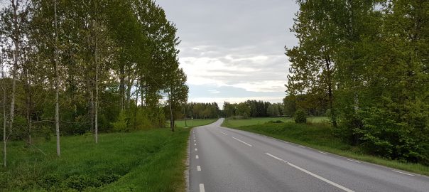
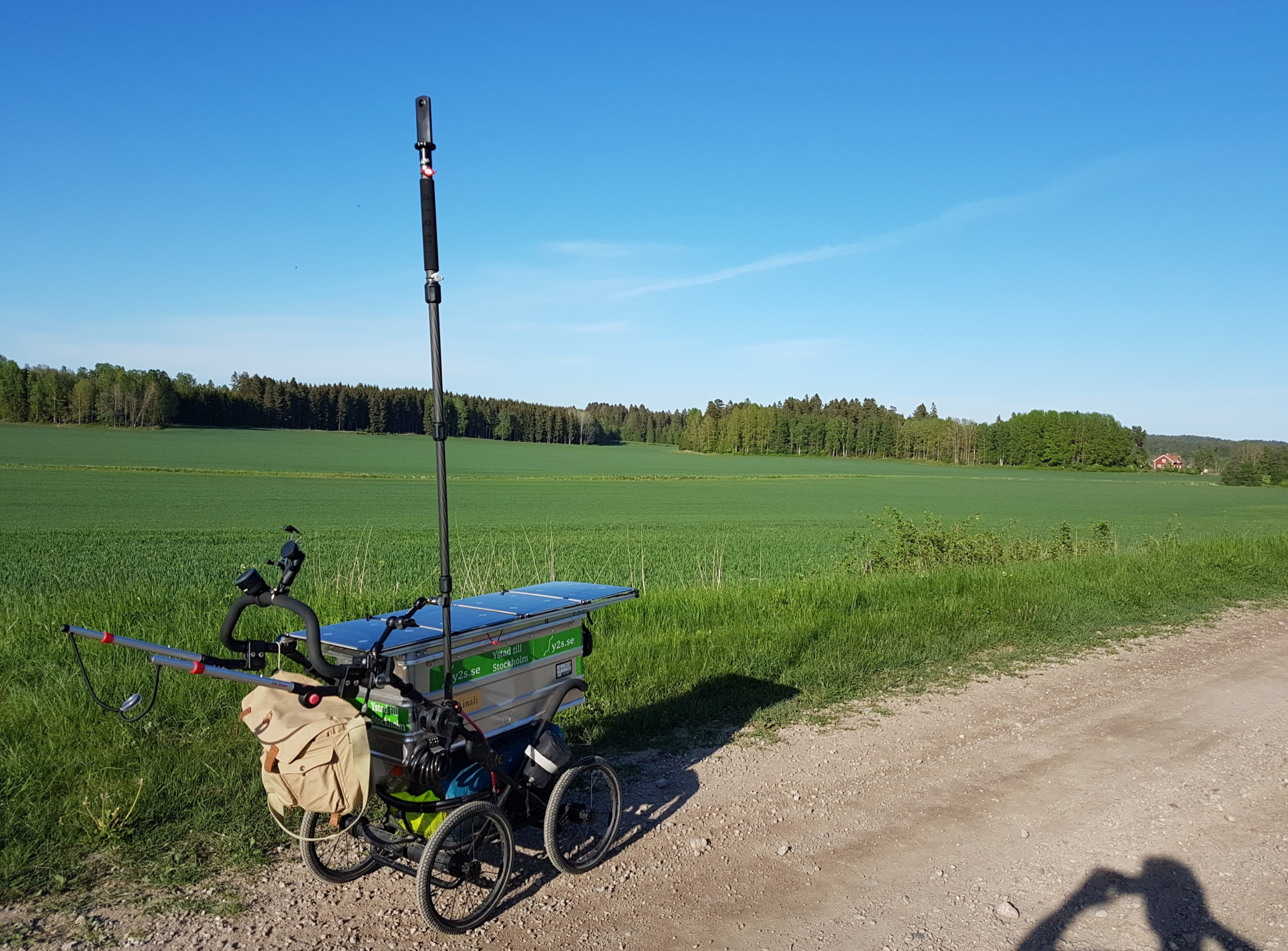
Another 8 or 9 kilometers were walked towards Nyköping before I stopped for the night.

[mapsmarker layer=”51″]

Statistics

For all days, see the statistics page.

Stretch

[table]
Stretch (km),Total stretch (km),Average/day
14.79,876.17,17.52
[/table]

Google Fit

[table]
Stretch (km),Time (hh:mm),Steps (#)
9.1,02:33,18939
[/table]

Finances

[table]
Food costs (SEK),Food total (SEK),Food/day,Project costs (SEK)
95,5182,104,
[/table]

Svenska / Swedish

Det var den varmaste natten hittills, lätt över tio grader. Jag gick upp och åt frukost som vanligt i den lummiga, vackra skogen innan jag började gå in mot Oxelösund.

Halvvägs så fick jag telefonsamtalet från Visit Sweden så att jag kunde komma åt @sweden-kontot. Jag började med att introducera mig med ett par tweets och fortsatte sedan gå. Jag stötte på ett ett gym och föreståndaren öppnade precis dörren så jag frågade om jag fick ta en dusch vilket jag fick. Efter fick jag dessutom en kopp kaffe!

Jag gick till biblioteket och jobbade lite. Många mejl skickades, jag kom ikapp med dagboken, uppdaterade några webbsidor och ladda upp lite bilder innan jag bröt för lunch. Efter det var det dags för mötet med Oxelösunds kommun. Både politiker och tjänstemän deltog och cheferna från båda också. Vi hade först en halvtimme introduktion innan vi djupdök och gjorde lite övningar. På det hela taget tyckte jag att det gick bra. De har inte hunnit göra så mycket än, men jag hoppas att jag kunde inspirera lite och också avmystifiera något om att det ska vara svårt.

Ytterligare 8-9 kilometer gicks mot Nyköping innan jag stannade för natten.

Om ni gillade att ha en svensk översättning, skriv gärna en kommentar, annars kör jag bara på engelska denna vecka.

[mapsmarker layer=”51″]

Statistik

För alla dagar, se statistiksidan.

Sträcka

[table]
Sträcka (km),Total sträcka (km),Snitt/dag
14.79,876.17,17.52
[/table]

Google Fit

[table]
Sträcka (km),Tid (tt:mm),Steg (st)
9.1,02:33,18939
[/table]

Ekonomi

[table]
Matkostnader (kr),Mat totalt (kr),Mat/dag,Projektkostnader (kr)
95,5182,104,
[/table]

Dag 49 – mot Oxelösund

Dagen började fint, men det kom lite regnstänk på förmiddagen. Som tur var kunde jag spänna upp en presenning så att vi kunde kura under den och spela lite kort. En grillning till lunch blev det innan det var dags att börja vandra. Då sprack det också upp och blev väldigt fint.

Det blev en ganska enkel vandring till precis utanför Oxelösund, där jag hittade en väldigt lummig men myggig plats.

Och som ni kan se av den bilden är jag alltså @Sweden den kommande veckan!

[mapsmarker layer=”50″]

Statistik

För alla dagar, se statistiksidan.

Sträcka

[table]
Sträcka (km),Total sträcka (km),Snitt/dag
18.45,861.38,17.58
[/table]

Google Fit

[table]
Sträcka (km),Tid (tt:mm),Steg (st)
13.2,04:06,22880
[/table]

Ekonomi

[table]
Matkostnader (kr),Mat totalt (kr),Mat/dag,Projektkostnader (kr)
0,5087,104,
[/table]

Dag 48 – sällskap igen!

Det slutade regna på natten så det var bekvämt att kliva upp. Vägen tog mig förbi Nävekvarn där jag lyckades få mig både dusch och kaffe.

Därefter var det lite mer vandring innan jag kom till Västra Kovik där mina föräldrar redan var. Bortanför badstranden hittade vi en mycket fin plats att campa på. Det var trevligt med sällskap på kvällen och variation i kosten med grillade championburgare.

[mapsmarker layer=”49″]

Statistik

För alla dagar, se statistiksidan.

Sträcka

[table]
Sträcka (km),Total sträcka (km),Snitt/dag
13.47,842.93,17.56
[/table]

Google Fit

[table]
Sträcka (km),Tid (tt:mm),Steg (st)
5.3,01:37,16640
[/table]

Ekonomi

[table]
Matkostnader (kr),Mat totalt (kr),Mat/dag,Projektkostnader (kr)
28,5087,106,
[/table]